Index of All Cemeteries Alphabetical Index of All Burials Previous Page
Use the following to search across all the cemeteries listed.
Example: "Smith, Roger" (yes, use the quotes)
155 MORING (Enslaved) [F14.2]
Williams. Off dirt road, 400 feet behind Moringsville Cottage, 1,000 feet west of SR 1731, O'Kelly Church Road, 0.15 mile south of O'Kelly's Chapel Christian Church on NC 751
Coordinates: 35d 51m 38.8s N; 78d 56m 40.9s W Click here for Online Maps
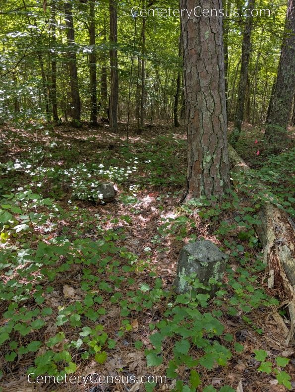
In 1989, Robert Hughes noted the two obelisks marking entrance to cemetery. On 25 May 1994, Will Heiser noted 4+ field stones. On 19 June 2025, Tom Miller and Ernest Dollar noted at least 6 field stones.
Photo of obelisks marking the cemetery entrance.
Owner: Kathryn Booth Butler.
Legal Description: Deed Book 346, Page 267, 10 Mar 1961.
Topo Quadrant: Green Level.
Family owned: Yes.
Abandoned: Yes.
Number of graves: 6+.
Cemetery size: 100' x 100'.
Restricted access: Yes. Private property.
Two 18" tall obelisks mark the entrance to the enslaved cemetery site in a pine grove, 50 feet south of the open meadow.
Not maintained. Difficult to locate in area with deep pine needles.
Enclosed: No.
Markers: Yes. Uninscribed fieldstones.
Additional graves might be identified if the area were cleaned of pine needles and leaves.
Last canvassed by: Robert Hughes, 1989; Will Heiser, 25 May 1994; Tom Miller and Ernest Dollar, 19 Jun 2025.
Web page updated 9 August 2025
Index of All Cemeteries Alphabetical Index of All Burials Previous Page
|
|
 |


__F14.2_)