Index of All Cemeteries Alphabetical Index of All Burials Previous Page
Use the following to search across all the cemeteries listed.
Example: "Smith, Roger" (yes, use the quotes)
126 DURHAM - RIGGSBEE - COLE [E52.2]
Location - Baldwin. North of SR 2538, Andrews Store Rd; 0.4 mile west of US 15-501. Address is 380 Andrews Store Rd., Chapel Hill, NC 27312. Cemetery is in front yard, on west side of drive.
Coordinates: 35d 48m 40.3s N; 79d 05m 57.3s W Click here for Online Maps
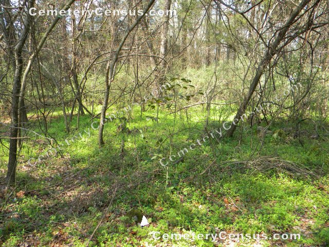
Main photo shows the site in 2012. Marker photos were taken in 2012.
Photo of the site after the cemetery was disturbed in 2022.
Aerial photo of the site in 2023, taken after the damage to the cemetery. Corner markers of the cemetery are visible.
In 1989 Gerald Oldham reported about ten markers, some inscribed. This cemetery is shown on lot 3 of Forest Creek Estates, plat 87-400.
Miscellaneous information: Glenn Lazarus and Bev Wiggins visited and photographed the site on 19 March 2012. Large stones scattered around the perimeter of the site suggest that it may have been enclosed by a stacked stone wall. The site was documented in 2012 and again after surface destruction in 2022.
Owner: Teresa Jessup Reed, Trustee in 2025. Previously Frank and Sally Norris.
Legal Description: Parcel 65226. Deed 2342/0127, Plat 87-400. Previously Deed 645/769 (1994). On lot 3 of Forest Creek Estates. Plat 87-400 shows cemetery.
Topo Quadrant: Farrington.
Abandoned: Yes.
Number of graves: 10 estimated.
Cemetery size: 75' x 45'. 0.07acre
White: Yes - according to oral tradition.
Restricted access: Yes. Private property.
Not easy to identify: Previously overgrown site was plowed over in 2022 by developer. Graves remain but all surface indications have been erased.
Enclosed: No. Developer was to have fenced the cemetery but apparently only corners were marked. The cemetery extent was marked by surveyor Van Finch based on plat 87-400.
Markers present: Previously, yes, but all fieldstones were removed by developer in 2022.
Inscribed markers: No.
Hazards to cemetery: Neglect and disrespect of boundaries since the site is not visually identifiable as a cemetery.
Listed: Yes. Gravesites of Chatham County.
Significant events: Gerald Oldham reported the cemetery in 1989. He indicated that it contained 8-10 graves. He and neighbors of the site say there was one stone with a date on it at that time, but it was not located in 2012. Oldham called this the Durham-Riggsbee cemetery. The source of that information is not known. Subsequent research suggests that the Cole family may have been associated with the site.
O&G Homes LLC was the owner/developer at the time that the cemetery was damaged (plowed over). A neighbor notified CCHA and the Chatham County Sheriff's Office. The Officer Rob Miller, Chatham County Sheriff's Office handled the investigation into damage at the site. Chatham County District Attorney, Troy Stone was also involved. Kelly Gomez, volunteer with the Chatham County Historical Association, documented the damaged site. The property was sold shortly after this incident.
Letter from Van Finch, surveyor, regarding boundaries of E52.2.
Last canvassed by: Gerald Oldham in 1989. Glenn Lazarus and Bev Wiggins on 19 Mar 2012. Kelly Gomez documented the site after damage by developer was reported in 2022.
 Unknown, Unknown (b. Unknown - d. Unknown) Unknown, Unknown (b. Unknown - d. Unknown) - Unknown, Unknown (b. Unknown - d. Unknown)
- Unknown, Unknown (b. Unknown - d. Unknown)
- Unknown, Unknown (b. Unknown - d. Unknown)
- Unknown, Unknown (b. Unknown - d. Unknown)
- Unknown, Unknown (b. Unknown - d. Unknown)
- Unknown, Unknown (b. Unknown - d. Unknown)
Web page updated 3 December 2025
Index of All Cemeteries Alphabetical Index of All Burials Previous Page
|
|
 |


