Index of All Cemeteries Alphabetical Index of All Burials Previous Page
Use the following to search across all the cemeteries listed.
Example: "Smith, Roger" (yes, use the quotes)
108 RIGGSBEE, LUKE [E33.4]

Location - Williams Township. 300 feet north of SR 1721, Lystra Road, across from Lystra Baptist Church. About 25 yards from the road. Will be part of the Valiant Reserve subdivision (2025).
Coordinates: 35d 50m 03.6s N; 79d 04m 44.0s W Click here for Online Maps
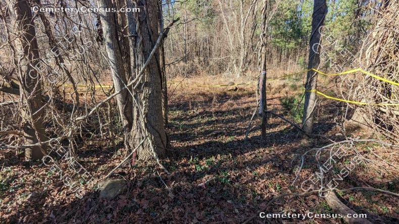
In 1989 Gerald Oldham reported an overgrown site with five unmarked stones which he identified as the Luke Riggsbee cemetery. The cemetery was found and documented in a 2019 report by Environmental Services Group for the Bold Development Group which details the deed trail and some family history of the site. The report notes that the land on which the cemetery is located was owned by Luke Riggsbee from the late eighteenth century until his death around 1838; however, it is unknown whether his remains are interred in this area. Other possible interments include Luke Riggsbee's father James Riggsbee, who died sometime after 1835; Elizabeth Riggsbee, wife of Luke, 1766-1850; John Riggsbee, son of Luke, 1791-c.1840; Ezekiel Riggsbee, son of Luke, 1791-c.1850.
Another view. - - - Another view. - - - Another view.
The property is being developed in 2025. Construction plats show the cemetery lot between residential lots 1 and 2 of the Valiant Reserve development. The developer has promised to buffer the cemetery, fence it, and provide a public access easement. The cemetery will be turned over to the HOA, which will be responsible for ongoing maintenance of the site.
Topo Quadrant: Farrington.
Legal: Parcel 18892. Deed 2327/0660, 2020. Plat 2022-19 shows cemetery. Plat references plat 2020-225 which shows the "old cemetery" on the 1.01 acre William Burgess parcel that is now part of 18892. See report referenced above for additional deed information.
Owner: 501 Prairie View LLC
Abandoned: Yes.
White: Yes.
Unrestricted access: Yes. An access easement to the cemetery will be provided by the developer per construction plat.
Overgrown and not easy to identify: Yes.
Enclosed: No in 2025, but the developer has promised to fence it.
Markers: Yes, fieldstones.
Markers with inscriptions: No.
Size of cemetery: Approx 32x32'.
Number of readable markers: 0.
Last canvassed by: Gerald Oldham. Date: 1989; Environmental Services Group, Sep 2019; Kelly Gomez visited the site with a representative of the developer and photographed the cemetery on 13 Jan 2023. Record updated 1/10/25 bbw.
Web page updated 12 January 2025
Index of All Cemeteries Alphabetical Index of All Burials Previous Page
|
|
 |


