Index of All Cemeteries Alphabetical Index of All Burials Previous Page
Use the following to search across all the cemeteries listed.
Example: "Smith, Roger" (yes, use the quotes)
442 BRYANT CEMETERY
Location - off far northern end of Reynolds Road (SR 1330) in Devotion Community. This is a remote and isolated area of Surry County.
Coordinates: 36d 28m 32.7s N; 80d 55m 58.7s W Click here for Online Maps
Directions: From intersection of Main Street and Kapp Street (Old Courthouse Square) take Kapp Street west (Turns into Zephyr Rd) and follow for 5.5 miles to a road on right side named Kapps Mill Rd. Turn right on that road and follow for 1.85 miles until it dead ends at River Rd. Turn right onto River Rd and follow for 3.5 miles until it dead ends at Haystack Rd. Turn left onto Haystack Rd (SR 1330 and go for 2.7 miles to a dirt road on right side just before entrance to Devotion. The road is named Reynolds Rd and is a gravel road (SR 1330). Turn right on that road go to end of state kept road. From the locked gate (see photo) one must have 4-wheel drive to access. This road was once known as Saddle Mountain Creek Road. Once inside the gate drive 0.9 mile to a logging road on left of Reynolds Road - park - cemetery is approximately 0.25 mile up the hill west of Reynolds Road and is reached by following the old logging / farm road that goes to the right and up the side of the hill. Cemetery is about 50 feet to the left of old logging / farm road on top of a ridge. Another view of cemetery.
This cemetery is on private property. The owner(s) live elsewhere in N. C. Visitors must obtain permission and will need a guide to get into the property.
Photographed and surveyed by Jack Luffman on 14 August 2012, with the assistance of Alfred Thompson, age 90, and Justice Hayes, age 79. Both men grew up in this isolated Black Community. (See 319 New Home Baptist Historical Cemetery for photos of these men.)
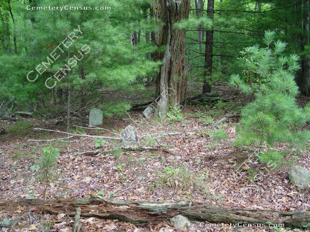
This is a black cemetery that may predate the Civil War in its beginnings - rocks only for monuments. Slaves and descendents of slaves were given land in this valley after the Civil War and several generations of African-Americans grew up here. There are more than 20 graves here. Neither Mr. Thompson nor Mr. Hayes can recall any specific names of people buried here other than knowing of it as the Bryant Cemetery, with the exception that a Mallie Bryant's husband is buried here. She is buried elsewhere.
Township: Bryan
Public or Private: Private
GPS Accuracy (ft): 20 feet
Elevation above sea level (ft): 1852
Status of Cemetery: Abandoned
Web page updated 15 April 2021
Index of All Cemeteries Alphabetical Index of All Burials Previous Page
|
|
 |

