Index of All Cemeteries Alphabetical Index of All Burials Previous Page
Use the following to search across all the cemeteries listed.
Example: "Smith, Roger" (yes, use the quotes)
387 LOW FAMILY CEMETERY
Location - Off Confederate Trail, Lowgap, Surry Co., NC.
Coordinates: 36d 32m 45.9s N; 80d 47m 54.2s W Click here for Online Maps
Directions: From I-77 and NC 89, go West abt 1/4 mile and turn Right on Round Peak Ch Rd. Then go abt 5.2 miles and turn Right on Old Lowgap Rd. Then go abt 1/2 mile and turn Left on Casper Stewart Rd. Then go abt 1.0 mile and turn Left on Fisher Peak Trail. Then go 1.2 miles and turn Right on Confederate Trail. Then go 3/10 mile and cemetery is on the Right..
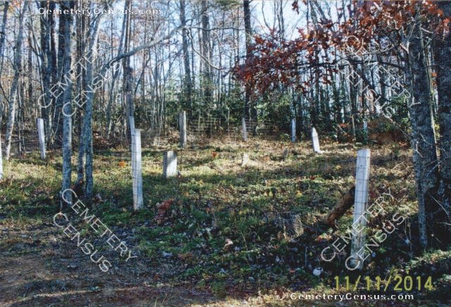
View of the cemetery sign with names listed.
Surveyed by Teresa Smith on June 16, 2007. Photographs by Teresa Smith in 2014.
Township or district: Stewart's Creek.
Public or Private: Private property.
GPS Accuracy (ft.): 9.
Elevation above sea level (ft.): 1454.
Status of cemetery: Maintained.
Surry County Parcel Number: 4072-00-12-6388. Calculated acres: 0.06.
13 known graves, 8 of which are marked on sign at cemetery.
 Flippen, Nora Eliza Hawks (b. 20 Feb 1905 - d. 3 Jul 1927) Flippen, Nora Eliza Hawks (b. 20 Feb 1905 - d. 3 Jul 1927) (on cemetery sign) Wife of William S. Flippen. Daughter of Tony Hawks and May Holfield Hawks.
- Flippen, Samuel W. (b. 3 Jul 1927 - d. 12 Jul 1927)
(on cemetery sign) Son of William Flippen and Nora Hawks Flippen.
- Hawks, Tony (b. Unknown - d. Unknown)
(on cemetery sign) Dates Unknown.
- Low, Delia Flippen (b. 7 Jun 1840 - d. 27 Jan 1924)
(on cemetery sign) Wife of James Kenny Low. Daughter of White Flippen and Ulsley Newman Flippen.
 Low, Eldridge H. "Shug" (b. 1868 - d. 2 Feb 1912) Low, Eldridge H. "Shug" (b. 1868 - d. 2 Feb 1912) (on cemetery sign) Aged about 45 years.
- Low, Isaac Claymon (b. 19 Apr 1860 - d. 6 Mar 1924)
(on cemetery sign) Never married. Son of Kenny Low and Dilia Flippen Low.
- Low, James Kenny (b. Apr 1833 - d. 15 Mar 1926)
- Low, Julianny Stewart (b. 1836 - d. 1858)
Web page updated 15 April 2021
Index of All Cemeteries Alphabetical Index of All Burials Previous Page
|
|
 |


