Index of All Cemeteries Alphabetical Index of All Burials Previous Page
Use the following to search across all the cemeteries listed.
Example: "Smith, Roger" (yes, use the quotes)
031 BRINDLE FAMILY CEMETERY
Location - Hayes Rd (SR 1107) and King Creek Lane, Dobson, Surry Co., NC.
Coordinates: 36d 20m 34.6s N; 80d 44m 19.7s W Click here for Online Maps
Directions: From intersection of Hwy 268 East and US Hwy 601, go west on Hwy 268 about 1 mile and turn right on Twin Oaks Rd, then go 1.7 miles and turn right on Haynes Rd. Then go 1.4 miles and turn right on King Creek Lane and go .4 mile past chicken houses and follow a farm road to an old farm house to the end of the road.
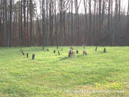
Another view of the cemetery.
Surveyed by Joe Hicks on October 1, 2006.
Township or district: Dobson.
Public or Private: Private property.
GPS Accuracy (ft.): 16.
Elevation above sea level (ft.): 1138.
Status of cemetery: Well maintained.
Surry County Parcel Number: 4984-00-78-8415.
There are about 20 very neatly arranged field stones that are unmarked and most are still standing. The property for years was the Fountain Brindle property.
Web page updated 15 April 2021
Index of All Cemeteries Alphabetical Index of All Burials Previous Page
|
|
 |

