Index of All Cemeteries Alphabetical Index of All Burials Previous Page
Use the following to search across all the cemeteries listed.
Example: "Smith, Roger" (yes, use the quotes)
030 BOWMAN FAMILY CEMETERY
Location - Siloam Rd, Ararat, Surry Co., NC.
Coordinates: 36d 22m 24.4s N; 80d 37m 35.5s W Click here for Online Maps
Directions: From intersection of US Hwy 52 and 601 in Mt. Airy, go south on US Hwy 601 (Rockford St) for 1.35 miles and turn left on Old US Hwy 601. Go 1.7 miles and turn left on Siloam Rd. Then go 5.9 miles and cemetery will be on the right. Is surrounded by a 4 ft. chain link fence and gates are locked.
Surveyed by Andy Hennis on April 1, 2006.
Township or district: Eldora.
Public or Private: Private property.
GPS Accuracy (ft.): 11.
Elevation above sea level (ft.): 1050.
Status of cemetery: Well maintained.
Surry County Parcel Number: 5925-00-08-9762.
GPS reading was taken from the center of the roadside fence. Most gravestones can be read from outside the fence.
Photographed and surveyed by Jack Luffman on 26 May 2011.
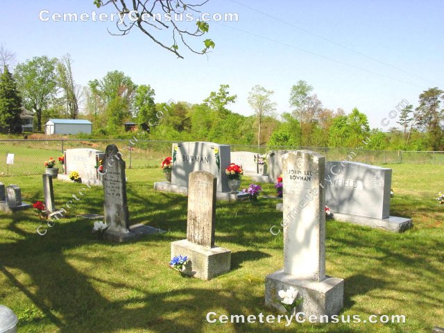
The cemetery was the scene of an accident several months ago - all stones but one were destroyed. The cemetery has been restored by John and Gaynell Lewis who maintain it beautifully.
 Atkins, Otis Junior (b. 27 Oct 1947 - d. 27 Oct 1947) Atkins, Otis Junior (b. 27 Oct 1947 - d. 27 Oct 1947) - Atkins, Stacy Mae (b. 6 Jan 1947 - d. 6 Jan 1947)
- Bowman, Alvis Lincoln (b. 24 Dec 1922 - d. 29 Jun 1980)
- Bowman, Carrie (b. 24 Jun 1838 - d. 10 Jun 1898)
Our Mother and Grandmother. Row 1
- Bowman, Etheleen Tilley (b. 14 Jul 1923 - d. 22 Aug 2002)
Wife of Willis Monroe Bowman. Row 2
- Bowman, George Washington (b. 10 May 1881 - d. 29 Aug 1953)
- Bowman, Harvey Edgar (b. 21 Jun 1903 - d. 19 May 1976)
- Bowman, John Lee (b. 2 May 1889 - d. 22 Oct 1937)
Husband of Minnie Bowman. This is the only stone not damaged by the wreck. SGT Central Officers Training School. Row 1
- Bowman, Lela Bell (b. 18 Nov 1914 - d. 11 Mar 1915)
Daughter of G. W. and R. B. Bowman. Row 1
- Bowman, Leva Etta (b. 2 Jan 1913 - d. 21 Feb 1976)
- Bowman, Minnie (b. Unknown - d. Unknown)
Wife of John Lee Bowman. Row 1
- Bowman, Ollie Mae (b. 17 Nov 1909 - d. 23 Mar 1980)
- Bowman, Oscar Lee (b. 5 Sep 1905 - d. 17 Mar 1987)
Husband of Ollie Mae Bowman. Bowman Family. PVT US Army WW-II. Row 3
- Bowman, R. M. (b. 7 Feb 1847 - d. 14 Nov 1926)
- Bowman, Rosie Bell (b. 2 Aug 1884 - d. 25 Oct 1924)
- Bowman, Willis Monroe (b. 16 May 1916 - d. 1 Feb 1991)
Husband of Etheleen Tilley Bowman. Pvt US Army WW-II Military marker. Row 2
- Holyfield, Connie B. Bowman (b. 6 Apr 1919 - d. 13 May 1996)
- Holyfield, Johnny Richmond (b. 1 Sep 1922 - d. 23 Sep 2005)
Husband of Connie B. Bowman Holyfield. Holyfield Family. PFC US Army WW-II. Row 3
- Turney, Mary Angeleen (b. 18 May 1945 - d. Reserved)
Wife of Moir Boyles Turney. Row 3
- Turney, Moir Boyles (b. 14 Jul 1948 - d. 26 May 1996)
Husband of Mary Angeleen Turney. Row 3
Web page updated 15 April 2021
Index of All Cemeteries Alphabetical Index of All Burials Previous Page
|
|
 |


