Index of All Cemeteries Alphabetical Index of All Burials Previous Page
Use the following to search across all the cemeteries listed.
Example: "Smith, Roger" (yes, use the quotes)
029 BLUES GROVE BAPTIST CHURCH CEMETERY
Location - 3069 Red Brush Rd, Mt. Airy, Surry Co., NC.
Coordinates: 36d 26m 17.6s N; 80d 42m 21.0s W Click here for Online Maps
Directions: From intersection of US Hwy 52 N and NC Hwy 89 W (W. Pine St) in Mt. Airy, go .7 mile to the stoplight in Toast and turn left on S. Franklin Rd. Go one block to the next stoplight and turn right on Toast Rd. Then go .7 mile and turn left on Red Brush Rd and go 7 miles and church and cemetery will be on the left. Church is on the corner of Red Brush and Fish River Church Rds.
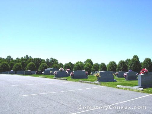
View of the church. View of the church sign.
Surveyed by Andy Hennis on May 6, 2006.
Township or district: Dobson.
Public or Private: Public Access.
GPS Accuracy (ft.): 9.
Elevation above sea level (ft.): 1050.
Surry County Parcel Number: 4998-00-82-2735.
Phone: 336-320-2895.
Some photographs provided by Charles Crabtree in 2009.
Surveyed and photographed by Jack Luffman in September 2010.
 Atkinson, Annie Haynes (b. 4 Oct 1924 - d. 14 Oct 2005) Atkinson, Annie Haynes (b. 4 Oct 1924 - d. 14 Oct 2005) Wife of Jesse F. "Skipper" Atkinson. Married 9 Oct 1943. Row 14
- Atkinson, Frank A. (b. 16 Jan 1881 - d. 4 Oct 1953)
Husband of Hessie E. Atkinson. Row 4
- Atkinson, Hessie E. (b. 6 Jan 1882 - d. 25 Jun 1959)
Wife of Frank A. Atkinson. Row 4
- Atkinson, Ila W. (b. 21 Jan 1907 - d. 6 Sep 2000)
Wife of William C. Atkinson. Row 13
- Atkinson, Jesse F. "Skipper" (b. 19 Jul 1923 - d. 8 Jan 2001)
- Atkinson, William C. (b. 17 Jul 1907 - d. 1 Mar 1988)
Husband of Ila W. Atkinson. Row 13
- Badgett, Anna A. (b. 1 Mar 1918 - d. 17 Feb 2004)
Wife of Floyd A. Badgett. Row 8
- Badgett, Claude H. (b. 1 Oct 1911 - d. 12 Apr 1990)
Husband of Lula P. Badgett. Row 3
- Badgett, Ella A. (b. 20 Jul 1920 - d. Reserved)
Wife of W. Ivan Badgett. Married 6 Dec 1939. Row 8
- Badgett, Floyd A. (b. 8 Jun 1913 - d. 1 Aug 1986)
Husband of Anna A. Badgett. Row 8
- Badgett, George H. (b. 28 Oct 1893 - d. 12 Feb 1980)
Husband of Ollie V. Badgett. Row 3
- Badgett, Joseph W. (b. 7 Aug 1892 - d. 15 Jan 1982)
Husband of Mary E. Badgett. Row 10
 Badgett, Lonnie Gray (b. 28 Nov 1951 - d. 23 Jul 2012) Badgett, Lonnie Gray (b. 28 Nov 1951 - d. 23 Jul 2012) Husband of Leesa Rhea Badgett. Son of W. Ivan Badgett and Ella Atkinson Badgett.
- Badgett, Lula P. (b. 30 May 1912 - d. 16 Dec 1971)
Wife of Claude H. Badgett. Row 3
- Badgett, Mary E. (b. 30 Jan 1896 - d. 9 Mar 1982)
Wife of Joseph W. Badgett. Married 8 Jan 1911. Row 10
- Badgett, Ollie V. (b. 13 Mar 1891 - d. 11 Mar 1976)
Wife of George H. Badgett. Row 3
- Badgett, W. Ivan (b. 13 Jul 1921 - d. 20 Jan 2011)
Husband of Ella A. Badgett. Row 8
- Blue, Edwin Martin (b. 18 Jun 1926 - d. Reserved)
Husband of Greta Hall Blue. Row 10
- Blue, Greta Hall (b. 29 Jun 1929 - d. Reserved)
Wife of Edwin Martin Blue. Married 9 Nov 1951. Row 10
- Branch, Anna V. (b. 17 Apr 1918 - d. 28 Feb 2002)
- Branch, Betty Fearrington (b. 27 Apr 1932 - d. Reserved)
Wife of William Neal Branch. Row 12
- Branch, Curtis J. "Gabby" (b. 7 Oct 1946 - d. Reserved)
Husband of Patricia Smith Branch. Row 7
- Branch, Donese M. (b. 19 Feb 1937 - d. Reserved)
- Branch, Edna Haynes (b. 18 Oct 1921 - d. Reserved)
Wife of W. Ray Branch. Married 16 Oct 1945. Row 1
- Branch, Glenn A. (b. 5 Oct 1931 - d. 19 Sep 2000)
Husband of Mearl T. Branch. Row 4
- Branch, Lina Mae (b. 19 Jul 1924 - d. 24 Apr 2008)
Wife of William Claude Branch. Married 10 Nov 1943. Row 4
- Branch, Mearl T. (b. 12 Nov 1936 - d. Reserved)
Wife of Glenn A. Branch. Row 4
- Branch, Nannie A. (b. 25 Feb 1904 - d. 27 Nov 1992)
Wife of W. Fletcher Branch. Row 4
- Branch, Patricia Smith (b. 18 Nov 1947 - d. Reserved)
Wife of Curtis J. "Gabby" Branch. Married 23 Dec 1967. Row 7
- Branch, W. Fletcher (b. 23 Jan 1904 - d. 4 Oct 1975)
Husband of Nannie A Branch. Row 4
- Branch, W. Ray (b. 23 Oct 1925 - d. Reserved)
Husband of Edna Haynes Branch. Row 1
- Branch, Wayne R. (b. 6 Sep 1936 - d. Reserved)
- Branch, William Claude (b. 16 Jul 1925 - d. Reserved)
Husband of Lina Mae Branch. Row 4
- Branch, William Howard (b. 22 Aug 1911 - d. 30 Sep 1994)
- Branch, William Neal (b. 6 Dec. 1935 - d. Reserved)
Husband of Betty Fearrington Branch. Row 12
- Brindle, Arthur F. (b. 16 May 1927 - d. 18 Feb 1978)
Husband of Maude B. Brindle. PFC US MARINE CORPS WW-II Military marker. Row 5
- Brindle, Maude B. (b. 16 Jul 1925 - d. 22 Nov 1997)
Wife of Arthur F. Brindle. Row 5
- Brindle, William Brian (b. 24 Dec 1972 - d. 15 Nov 1976)
- Burton, Pamela B. (b. 1 Mar 1969 - d. Reserved)
Wife of Timothy Ray Burton. Married 12 June 1987. Row 7
- Burton, Timothy Ray (b. 3 Oct 1959 - d. Reserved)
Husband of Pamela B. Burton. Row 7
- Carpenter, Opal V. (b. 14 Mar 1920 - d. 28 Feb 2010)
Wife of Preston E. Carpenter. Row 8
- Carpenter, Preston E. (b. 5 May 1919 - d. 6 Jul 2007)
- Coble, Kermit J. (b. 25 Jun 1925 - d. Reserved)
Husband of Mary Stella B. Coble. Row 4
- Coble, Mary Stella B. (b. 5 Mar 1923 - d. 3 Jun 2009)
Wife of Kermit J. Coble. Married 11 June 1943. Row 4
- Cuthrell, B. Dean (b. 24 Nov 1964 - d. 3 Jan 2001)
- Dollyhigh, Janette B. (b. 23 Jun 1908 - d. 11 Jan 1997)
Wife of Lacy H. Dollyhigh. Row 11
- Dollyhigh, Lacy H. (b. 4 Jul 1905 - d. 17 Feb 1979)
Husband of Janette B. Dollyhigh. Row 11
- Dollyhigh, Lester M. (b. 10 Jan 1908 - d. 31 Jul 1964)
Husband of Mamie T. Dollyhigh. Row 6
- Dollyhigh, Mamie T. (b. 16 Sep 1915 - d. 31 Dec 2001)
Wife of Lester M. Dollyhigh. Row 6
- Draughn, Archie Lee (b. 12 Dec. 1918 - d. 13 Nov 1995)
Husband of Connie Nichols Draughn. T SGT US ARMY WW-II Military marker. Row 1
- Draughn, Bessie Marsh (b. 8 Jul 1922 - d. Reserved)
Wife of Frank Ottis Draughn. Married 53 years. Row 2
- Draughn, Connie Nichols (b. 29 Jun 1919 - d. Reserved)
Wife of Archie Lee Draughn. Row 1
- Draughn, Frank Ottis (b. 14 Jun 1917 - d. 14 Dec 2002)
Husband of Bessie Marsh Draughn. Married 53 years. PFC US ARMY WW-II Military marker. Row 2
- Draughon, Margaret M. (b. 25 Nov 1919 - d. 5 Jun 2001)
Wife of Marvin S. Draughon. Row 9
- Draughon, Marvin S. (b. 15 Nov 1914 - d. 10 Jan 1989)
- Freeman, DeWitt (b. 1916 - d. 1971)
Husband of Frances A. Freeman. Row 8
- Freeman, Frances A. (b. 1920 - d. 1994)
Wife of DeWitt Freeman. Row 8
- Gooch, Mary P. (b. 16 May 1947 - d. Reserved)
Wife of Robert H. Gooch. Row 13
- Gooch, Robert H. (b. 25 Feb 1933 - d. Reserved)
Husband of Mary P. Gooch. Row 13
- Gordon, Charlie B. (b. 4 Jul 1902 - d. 6 Jul 1986)
Husband of Gracie Mae Gordon. Row 12
- Gordon, Gracie Mae (b. 16 Jan 1919 - d. 3 Apr 2008)
- Hall, Clinton D. (b. 21 Oct 1946 - d. 19 Jan 1998)
Husband of Ruby E. Hall. Row 8
- Hall, Ruby E. (b. 28 May 1947 - d. Reserved)
Wife of Clinton D. Hall. Married 26 Dec 1965. Row 8
- Haymore, Ellis W. (b. 6 Dec 1922 - d. 18 Jun 2005)
Husband of Lula S. Haymore. Row 3
- Haymore, Loyd "Bud" (b. 8 Sep 1911 - d. 24 May 2005)
Husband of Ruth B. Haymore. Row 13
- Haymore, Lula S. (b. 11 May 1923 - d. 18 Feb 2007)
Wife of Ellis W. Haymore. Married 31 July 1943. Row 3
- Haymore, Rufus Cleve (b. 8 May 1941 - d. 1 Jun 1941)
Son of Mr. and Mrs. Loyd Haymore. Behind church
- Haymore, Ruth B. (b. 17 Jun 1913 - d. 26 May 1994)
Wife of Loyd "Bud" Haymore. Row 13
- Hodges, Roger Dale (b. 17 Nov 1945 - d. 6 Mar 1996)
- Hodges, Susan A. (b. 1949 - d. Reserved)
Wife of Roger D. Hodges. Row 8
- Johnson, Eugene B. (b. 30 Dec 1929 - d. Reserved)
Husband of Mildred B. Johnson. Row 11
- Johnson, Karen Montgomery (b. 1 Jul 1954 - d. Reserved)
Wife of Michael Ray Johnson. Row 14
- Johnson, King Brady (b. 20 Dec 1905 - d. 30 Nov 1995)
Husband of Mary McHone Johnson. Row 14
- Johnson, Mary McHone (b. 14 Aug 1908 - d. 17 Jul 1997)
Wife of King Brady Johnson. Row 14
- Johnson, Michael Ray (b. 19 Jun 1955 - d. 8 Mar 1996)
Husband of Karen Montgomery Johnson. Row 14
- Johnson, Mildred B. (b. 8 Jul 1931 - d. 1 Jul 1990)
Wife of Eugene B. Johnson. Row 11
- Joyce, Fletcher "Red" (b. 23 Feb 1930 - d. 28 Apr 2016)
Husband of Mary Frances Branch Joyce. Son of David Fletcher Joyce and Vallie Watson Joyce. Row 9
- Joyce, Mary Frances Branch (b. 23 Apr 1938 - d. 16 Feb 2016)
Wife of Fletcher "Red" Joyce. daughter of Howard William Branch and Ana Vivin Badgett Branch. Row 9
- Kunce, Phillip Dwain (b. 30 Aug 1946 - d. 8 Nov 1946)
- MaHone, Jesse Franklin (b. 11 May 1889 - d. 7 Jun 1915)
NORTH CAROLINA PVT 56 PIONEER INF. Behind church
- Marion, Avis Bowlin (b. 13 Feb 1917 - d. 15 Feb 2009)
Wife of Herman Edward Marion. Row 14
- Marion, Edward Mitchell "Eddie" (b. 4 Nov 1949 - d. 24 Jun 2008)
Stone is located as if this person is buried with Herman Edward Marion and Avis Bowlin Marion. Row 14
- Marion, Herman Edward (b. 16 Feb 1921 - d. 3 Nov 2005)
Husband of Avis Bowlin Marion. Row 14
- McCraw, Lizzie A. (b. 29 Jun 1910 - d. 25 Jul 1991)
Wife of McKinley McCraw. Row 4
- McCraw, McKinley (b. 11 Jun 1904 - d. 12 Dec 1979)
Husband of Lizzie A. McCraw. Row 4
- McCreary, Celia D. (b. 25 May 1915 - d. 27 Mar 1997)
Wife of Samuel C. McCreary. SGT US MARINE CORPS WW-II Military marker. Row 6
- McCreary, Samuel C. (b. 26 Dec 1918 - d. 8 Oct 1986)
Husband of Celia D. McCreary. Row 6
- McHone, Jack G. (b. 14 Feb 1929 - d. 9 May 1994)
Husband of Lela M. McHone. Row 14
- McHone, Lela M. (b. 22 Sep 1905 - d. 2 Aug 1994)
Wife of Jack G. McHone. Row 14
- Mitchell, Alice H. (b. 21 Sep 1923 - d. 27 Oct 2009)
Wife of Jacob B. Mitchell. Behind church
- Mitchell, Jacob P. (b. 18 Aug 1914 - d. 4 Nov 1986)
Husband of Alice H. Mitchell. Behind church
- Mitchell, John D. (b. 11 Feb 1940 - d. 18 Mar 1940)
Son of J. P. and Alice Mitchell. Behind church
- Nations, Polly M. (b. 26 Jun 1937 - d. Reserved)
Wife of William L. "Billy" Nations. Row 6
- Nations, William L. "Billy" (b. 8 Sep 1934 - d. Reserved)
Husband of Polly M. Nations. Row 6
- Nichols, Frankie Ann Moore (b. 30 Jan 1937 - d. 7 Sep 1996)
Wife of Gray Donald Nichols. Row 6
- Nichols, Gray Donald (b. 11 Aug 1934 - d. 1 Jan 1996)
Husband of Frankie Ann Moore Nichols. Row 6
- Nichols, Infant (b. 28 Oct 1959 - d. 28 Oct 1959)
Infant son of Mr. and Mrs. Ernest Nichols. Row 5
- Nichols, Pauline M. (b. 18 May 1930 - d. 13 Nov 2001)
Wife of Rev. Earnest Y. Nichols. Row 5
- Nichols, Rev. Earnest Y. (b. 9 Oct 1930 - d. 7 Feb 2010)
- Peele, Howard Y. (b. 1 Nov 1908 - d. 9 Feb 1987)
Husband of Nannie Lena Peele. Row 13
- Peele, Nannie Lena (b. 23 Sep 1910 - d. 5 Mar 2001)
Wife of Howard Y. Peele. Row 13
- Ray, Jeremy Brett (b. 24 May 1986 - d. 26 May 2007)
- Rayley, Evelyn M. Todd (b. 13 Nov 1913 - d. 29 Mar 2000)
Wife of Raymond E. Rayley. Row 15
- Rayley, Raymond E. (b. 27 Apr 1922 - d. 18 May 1986)
Husband of Evelyn M. Todd Rayley. Row 15
- Riggs, George W. (b. 2 Apr 1870 - d. 22 Dec 1939)
Husband of Nancy Riggs. Behind church
- Riggs, Nancy (b. 21 Oct 1868 - d. 19 Feb 1958)
Wife of George W. Riggs. Behind church
- Riggs, Onita B. (b. 7 Jun 1927 - d. Reserved)
Wife of Paul E. Riggs. Row 12
- Riggs, Paul E. (b. 25 Dec 1927 - d. Reserved)
Husband of Onita B. Riggs. Row 12
- Riggs, Rocenia F. (b. 28 Mar 1897 - d. 14 May 1983)
- Simpson, James Ray (b. 2 Jan 1937 - d. Reserved)
Husband of Jo Ann Simpson. Row 9
- Simpson, Jo Ann (b. 11 May 1940 - d. Reserved)
Wife of James Ray Simpson. Row 9
- Tilley, Dixie (b. 8 Sep 1881 - d. 10 Feb 1951)
Husband of Martha P. Tilley. Behind church
- Tilley, Martha P. (b. 3 Sep 1876 - d. 5 Sep 1964)
Wife of Dixie Tilley. Behind church
- Tolbert, Betty Marie "Ma" (b. 6 Aug 1931 - d. 19 Dec 2008)
Wife of Wilbur Lee Tolbert. Row 11
- Tolbert, Wilbur Lee (b. 7 Feb 1940 - d. Reserved)
Husband of Betty Marie Tolbert. Row 11
- Watson, Dixie A. (b. 21 Dec. 1904 - d. 28 Jan 1981)
Husband of Mary J. Watson. Row 7
- Watson, Mary J. (b. 17 Oct 1901 - d. 13 Oct 1967)
Wife of Dixie A. Watson. Row 7
- Whitaker, Margie D. (b. 3 Mar 1932 - d. 7 Apr 2006)
Wife of Robert Wayne Whitaker. Married 3 July 1952. Row 11
- Whitaker, Robert Wayne (b. 25 Sep 1932 - d. 10 Nov 1993)
Husband of Margie D. Whitaker. Row 11
- Wilson, David L. (b. 12 Jan 1949 - d. 4 Jul 2010)
- Wilson, Sherman Leo (b. 8 May 1923 - d. 23 Aug 2005)
Web page updated 15 April 2021
Index of All Cemeteries Alphabetical Index of All Burials Previous Page
|
|
 |


